My friends from Bulgaria mentioned that they wanted to visit The Cape Of Good Hope. "The Cape Of Good Hope?", I asked very surprized. I never knew there was a place called the Cape Of Good Hope. Didn't one of the first settlers call this whole area the Cape of Good Hope before they wandered deeper into the interior of the country only to be met by hostile cattle thieves? Certainly no "good hope" in that prospect. Maybe these seafarers arrived on a good sunny day, because not long before it was named the Cape of Good Hope it was actually referred to as the Cape of Storms by Bartholomeu Dias and his crew. Anyway, I don't want to go into the history of the name, but I wanted to go see where and what the Cape of Good Hope was. A place that my expat-friends wanted to see again after leaving Cape Town some years ago for another work assignment elsewhere.
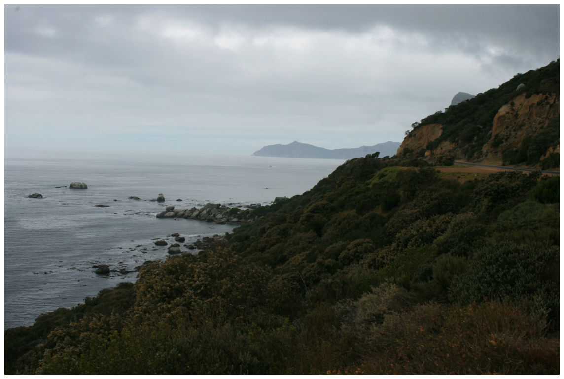 |
| The road to Cape Point seen through my lens. |
So, from Muizenberg I went further south past James Beach where I previously took the colourful pictures of the beach huts all the way down to Simons Town and Boulders Beach where the penguins sleep. I only stopped once to put my bike jacket on again after taking it off in Muizenberg. For a moment I was thinking that this cloud cover might be more than just fog and that it might be a weak cold front. After Simons Town the road became narrower and from there on I was actually on a road that I've only been on more than ten years ago. Needless to say the road along with the cliffs are spectacular, but I was not really impressed as much as I am with other places on the South African coastline. Apart from the Swartkops Mountain on the right and False Bay on the left, there was not much to look at. The place is rather uninhabited and I am pleased that the tranquility of this world known peninsula had been preserved in some way. The only place where some activity was spotted was a little settlement called Smitswinkel Bay. In 2006 a foreigner living in South Africa bought the last 40 hectares piece of undeveloped land at Smitswinkel bay for R7.73 million. This was supposed to become a World Heritage Site, but the Table Mountain National Park couldn't afford to buy the land and incorporate it with the neighbouring park in order to let that happen. Yet again a wealthy foreigner comes and buy a piece of our country for millions just because he can. The only other inhabitants here that are frequently seen here are baboons. I didn't take pictures of Smitwinkel Bay, but here are one or two taken on a more sunny day by someone else.

The name Smitswinkel (‘the blacksmith’s shop’) was given to this pretty little bay because of two rocks that jut out of the sea which resemble an anvil and a bellows. The little settlement is on the right hand side of the photo.
Once past Smitwinkel Bay, the road actually turns west across the peninsula toward the Atlantic side, not continuing down to Cape Point as one would expect. Cape Point is inside the Table Mountain National Park and obviously one cannot see this without paying to enter. Some people wrongly believe that Cape Point is Africa's furthest southern point. This privilege actually belongs to Cape Agulhas, 150km to the southeast. I wasn't planning on entering the Nature Reserve on such a cloudy day, and because I still haven't found the Cape of Good Hope, I quickly looked on Wikipedia to see if it actually exists. This is what I found:
The Cape of Good Hope is a rocky headland on the Atlantic coast of the Cape Peninsula, South Africa. The term Cape of Good Hope is also used in three other ways:
- It is a section of the Table Mountain National Park, within which the cape with the same name, as well as Cape Point, falls. Prior to its incorporation into the national park this section constituted the Cape Point Nature Reserve;
- It was the name of the early Cape Colony established in 1652, in the vicinity of the Cape Peninsula.
- Just prior to the formation of the Union of South Africa, the term referred to the entire region that in 1910 was to become the Cape of Good Hope Province (usually shortened to the Cape Province).
I guess I was close enough. Not feeling the least bit disappointed or ashamed that I did not discover it on my own like the early seafarers did, I "passed the start, collected my R200" and headed straight for the Atlantic side of the Peninsula, much more excited about seeing places like Kommetjie, Long Beach and Chapman's Peak Drive....
End of Part Two.....


