
But what if King Kong's face was this big, would you still be a man then....?

 After the disappointment of last week seeing the guys paraglide on Lion's head while we were climbing Table Mountain, the desire to do a flight never subsided. I've been watching the weather since then, but was away to Plettenberg Bay and the other times I was either at work or doing something else. Not that the weather is so aften good to fly Lion's Head, but when I saw the wind predictions for the day I knew I had to make an effort to get there because you never know when your next chance is going to come.
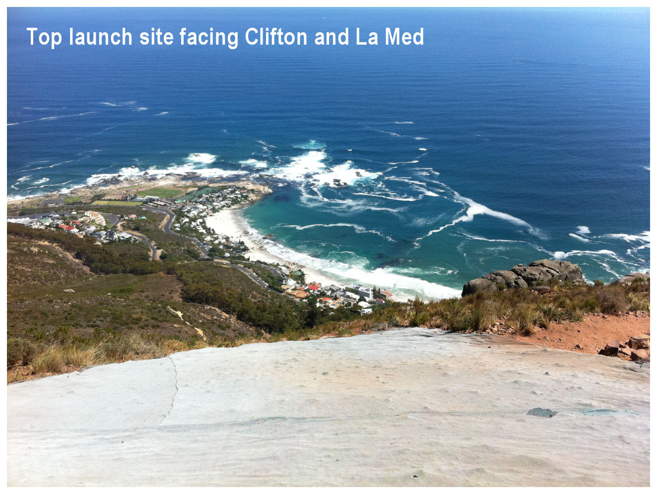
 There are two take-off / launch sites at Lion's head. One facing Camps Bay and the other facing Clifton Beach. Both are very short launches. The first one you have to deal with a bunch of trees that sits like hungry Venus Fly Traps waiting for their prey, and the second one has a sharp drop that lands you back on the footpath...or on some hiker's head. The official landing area is a small grass patch in front of La Med, where the view is great, the girls are hot and the drinks are friggen expensive. There are other less favourable places to land if you sink out too fast or if the wind blows you off course...like Camps Bay (get fined by police) or the sports field of Camps Bay High (get laughed at by school kids). It's a 15 minute walk to the first launch, but when we got there we could see that the wind was not going to assist us in launching there, so we headed further up an even steeper section to get to the second launch site. On our way up we were passed by a tandem in flight and we could see that there was not much lift. But with the thermal pockets one might just be able to stay up. Anyway, a top-to-bottom, or "foofie" as it is also called was also acceptable at this stage as this is still better than being grounded.
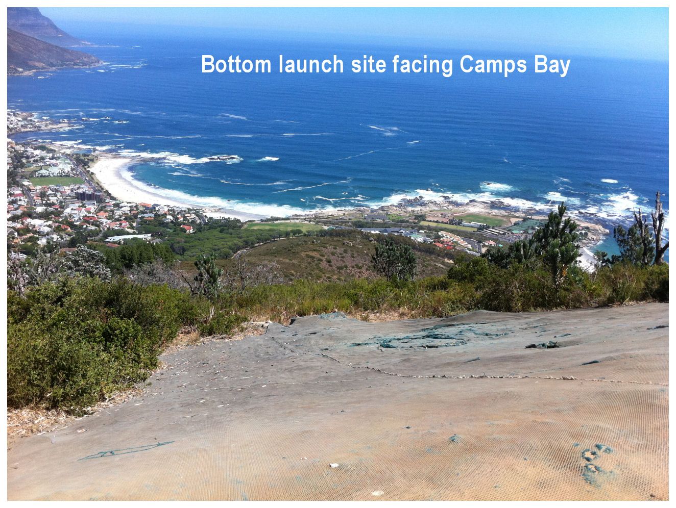

 Once at the second launch site, we met up with Jacques, an experienced paragliding trainer and tandem pilot. He was also the first on the scene when Michelle had her "bad landing". He suggested we do a forward launch as the wind was not very strong, but I have no confidence in launching forward. Even after 8 years of paragliding I avoid a forward launch if possible. The concern was showing on Michelle's face, but she laid out her glider with the help of one of Jacques' assistants and clicked in. On her first attempt the glider veered off to the right so she tried a second time. There wasn't much wind. She also does not like forward launch, but this time she did it according to the book and off she went.
 I immediately felt that there was very little lift, but with the occasional pockets of warm air I managed to get a reasonable flight, although it would probably not fall under the category "flight" but rather under "extended foofie". I tried to stay close to the ridge and flew over the first launch site with the "Venus Fly Traps" but on my return and despite some more pockets, I could see that I was not going to stay up for long. I did a few turns and eventually decided to head out to La Med. I still had enough altitude to make a wide turn over the sea via Clifton and to come back in for a safe landing. The windsock was hanging straight down so landing could be done from any direction this time. Michelle was busy admiring her gear and taking pictures of it when I started my approach. For some reason my landing gear wasn't extended fully in time and I did a bit of "arse-landing" in front of a fully packed La Med. Fortunately I recovered well and avoided any further embarrassments...apart from the fact that I stood in dog poop later while folding my glider. Michelle's face looked much different than what it did at the launch and I could see she was real chuffed with herself...or maybe she was just smiling at my landing. Jacques pulled in just behind us with his tandem pax and handed me my glasses.
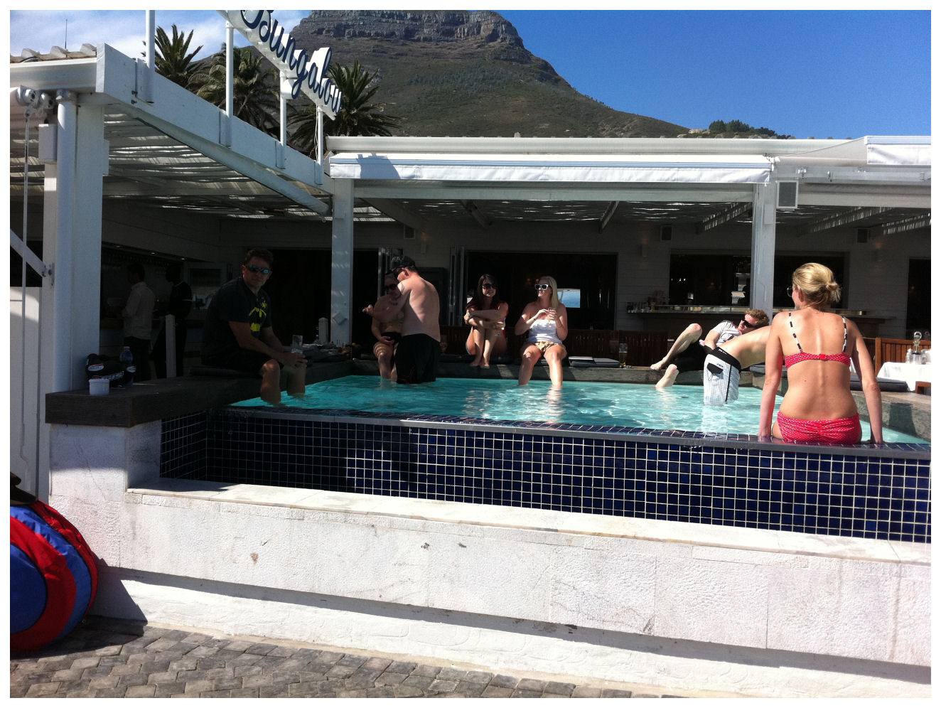
 Once you've landed at La Med you obviously need to get back to your car which is usually parked where the footpath on Lion's Head starts. I usually hike a lift from passing cars, so we decided to get something to drink before we tried our luck. La Med is a really awesome place to hang out, but heavily overpriced. A 500 ml water costs seventeen bucks, where you would pay R5 for the same bottle in Pick & Pay. But the place is packed with the bold and the beautiful and it was nice to hang out their like a real "larneys" dipping our feet in the pool. The second option to get back to your car is to take a taxi, but that can work out between R35 and R50 a shot. With that money I could buy two 220ml cans of Coke at La Med...or six 330 ml cans at Pick & Pay. As we walked out to the street the guys from Cape Town Tandem Paragliding was on their way up again and offered us a lift for free. So, getting back to the car was actually quicker and with less effort than walking up Lions' Head and doing our "extended foofies". Perfect.


 My plan was to stay on tar until I got to Avontuur, but 50 kilometers down the R62 the lady with the sweet voice on my GPS suggested that I take a shortcut straight to De Vlugt. The nice lady didn't say anything about the road surface or conditions, but I guess the "Unpaved Road" clue on the GPS screen should've warned me that it was not going to be without mental and physical challenges. I stopped at the turn-off and thought that a short-cut might be a good idea to beat the rain to De Vlugt. I ventured out on my second gravel road with caution as this decision was rather unplanned. I didn't want to jinx my trip because of changed plans. As a good friend of mine always says, "You change your mind you lose your luck!"


 Less than a 100 meters into unknown territory, I already started cursing myself for the weakness I have for sweet female voices. The road condition was not as good as the Montague Pass road, but with determination I decided to press on ahead. This was the part that tested the "Get back on the horse again if you still want to remain a cowboy"-theory. I wasn't about to let an ego thing make the decision for me. I decided to stick to the road regardless of untested theories. This time I was in it for the sake of "adventure". I have never been on this road before and didn't know what to expect, but with lots of patience and the occasional glimpse on my GPS screen I managed to negotiate all the tight turns by slowing down way in advance. The bit of advice from the forum that I really took to heart was the "take it slow" bit. Up until now I was fortunate not to have hit loose sand, but I am sure it would've been much easier to manage the sand travelling at 40 km/h rather than 80.


 It's that time of the year where the cold fronts start making their way closer to the African continent. To me that just means one thing....depression. This weekend a second weak cold front aimed at the Cape, but fortunately didn't spoil the weekend too much. Last week I was a bit depressed because my weekend didn't result in much and I was fearing that I might have a second one in a row. Fortunately a friend of mine called unexpectedly to ask me if I wanted to go paragliding at Porterville. She recently had a very unfortunate accident on Lion's Head and broke her back. She explained to me what was crushed in her back and everything but I was just relieved that she could still walk. She is on the road of recovery and obviously determined to get her life back on the road...and her paraglider in the air. After weighing up our options and talking about bucket lists and things you have to do before you die, we eventually dropped the paragliding idea and decided to walk up Table Mountain instead. Porterville was too far to drive and Lion's head was going to blow out, and seeing that walking up Table Mountain was still on her bucket list, we decided to do just that.
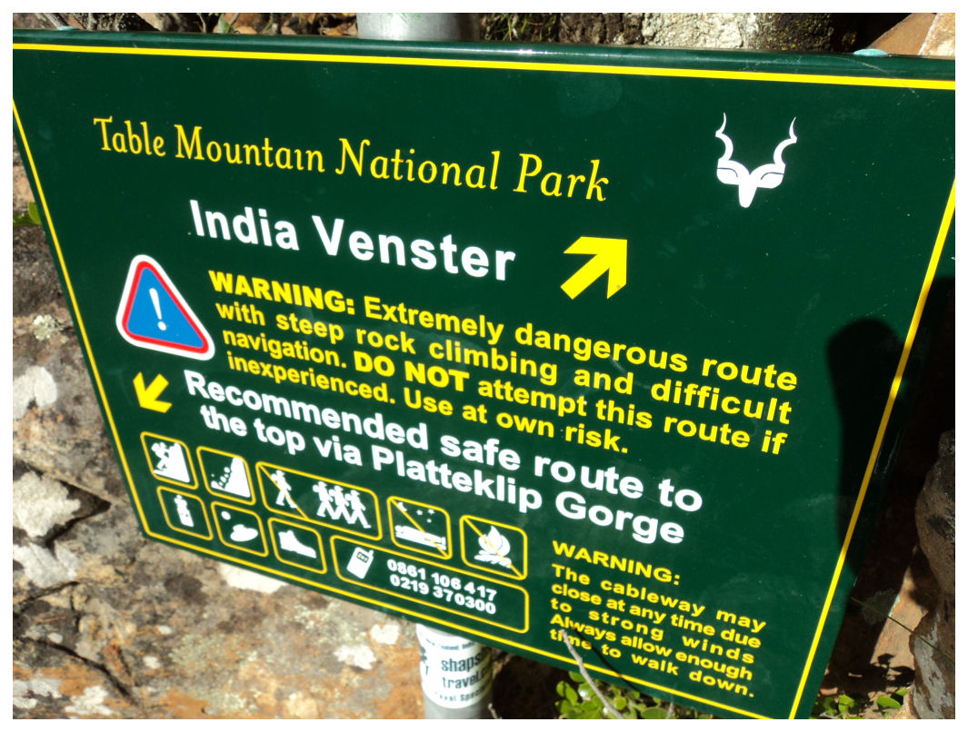 I have walked up Table Mountain a few times, but I cannot exactly remember how many times. There are many routes that one can take, so you can basically start on any side of Table Mountain and reach the top in one way or the other. I would say the most boring way up is Platteklip Gorge with steps taking you into the gorge and spoiling the view and excitement completely. Perfect place to take your family for a walk. I did another route some time ago called the India Venster ("Window"), but I remember getting lost at a point and wasting about 45 minutes trying to get back to the route. The name India Venter apparently comes from a hole in the rocks that when viewed from a certain point resembles the map of India. If you look through it you see spectacular views on the other side. I still have to find it. We once did a walk over Devil's Peak all the way to the top, and got slightly lost as well but managed to find our way again. Anyway, with a slightly damaged paragliding patient I didn't want to take on a hectic route, but Platteklip Gorge was just too easy. We made the decision that we will walk up halfway and where the road splits, we will make a call depending on her back.
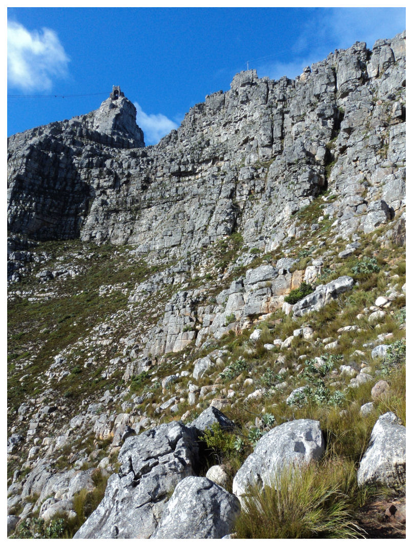
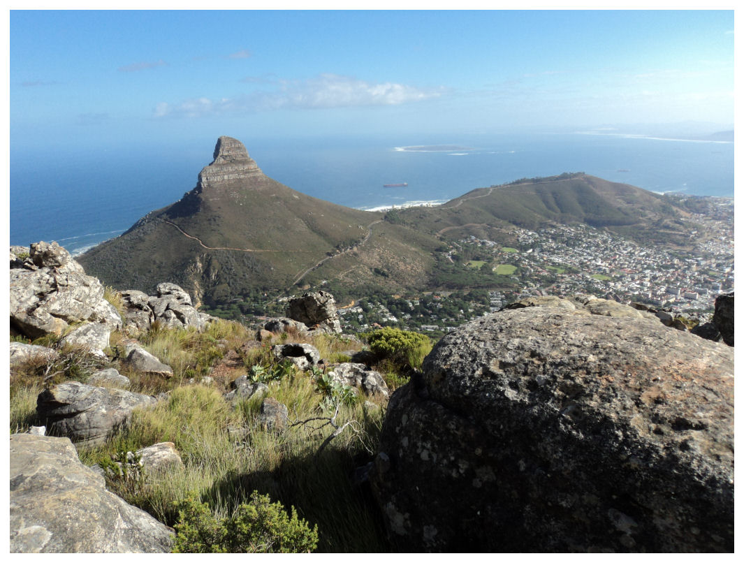
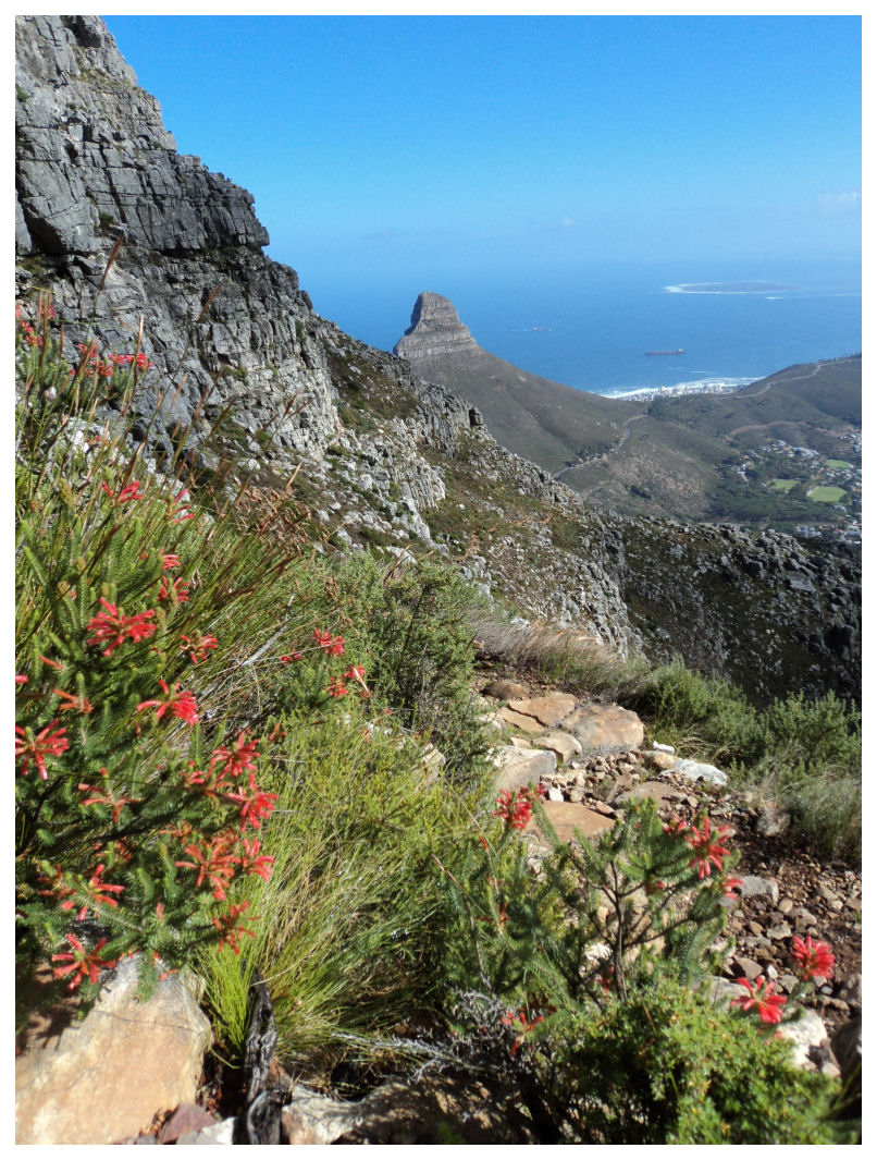
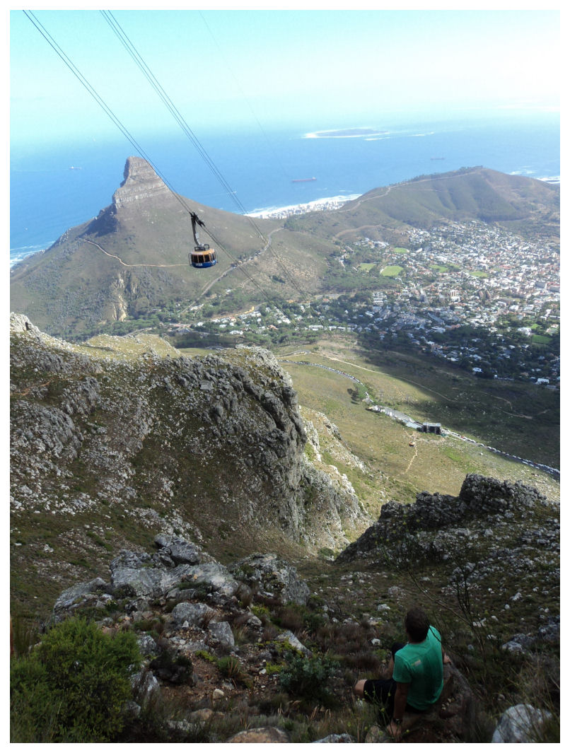
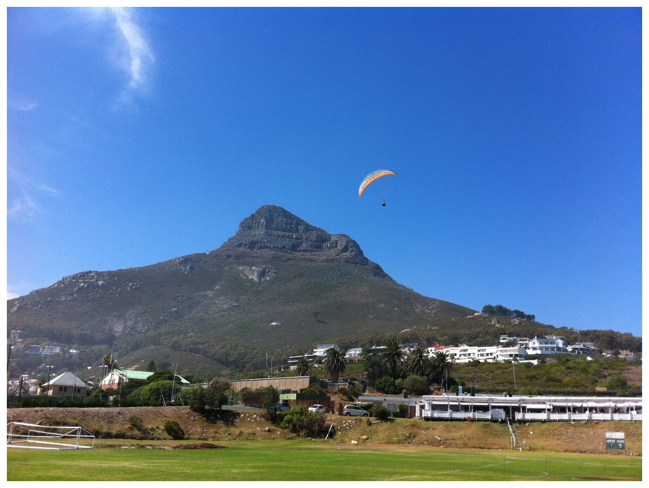
 The climb was getting steeper, so we made frequent stops to appreciate the view and to sometimes wave at the passengers in the cable cars. When you look in front of you and at the top cable car station you wonder if you will ever get up there. I was a bit worried about my hiking partner, but she was really doing well and constantly had to re-assure me that her back was fine. As we were walking up we noticed some paragliders taking off from Lion's Head and we had to convince ourselves that the site will be blown out quickly and that they would all have to land soon. We were there to cross out an item from a bucket list and we were going to complete it, come hell or high water.
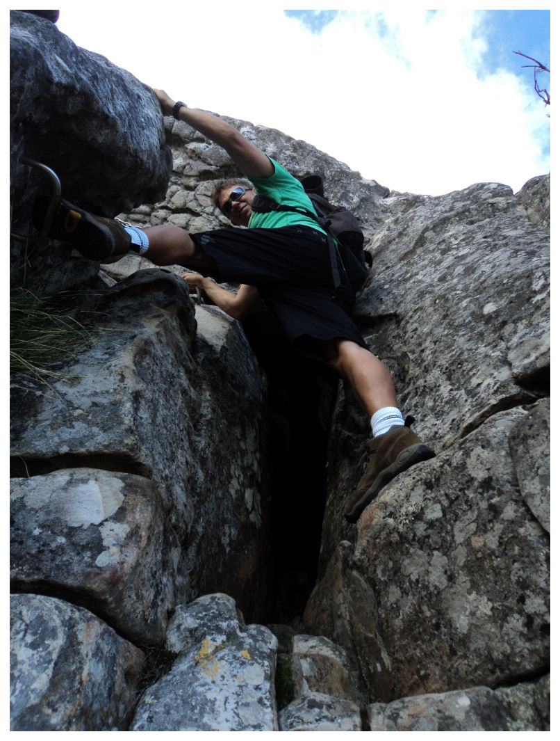
 Navigating India Venster is indeed a bit troublesome. You move away from a clear footpath and eventually end up climbing rocks. It is not too difficult to climb, the rocks all seems to have natural handles where you can grab onto, but if you did not do the jungle gym thing when you were a kid you might struggle to get up. To solve the navigation issue some yellow footprints were painted on some of the rocks, and sometimes you are really please to see one in the distance. There are times when you look up and think to yourself that you might be stuck, but somehow you find your way again and you move on. I was a bit disappointed when I reached a difficult climbing spot where they actually put up some stainless steels climbing footsteps and chains. Although this obviously helps a lot, I think they have dropped the difficulty rating by a few bars. My only issue getting up there was my walking stick that was always in the way, but we both did the climbing with ease. Every now and then we would throw our eyes into the direction of Lion's Head to see if the paragliders were gone, but somehow they managed to keep flying.
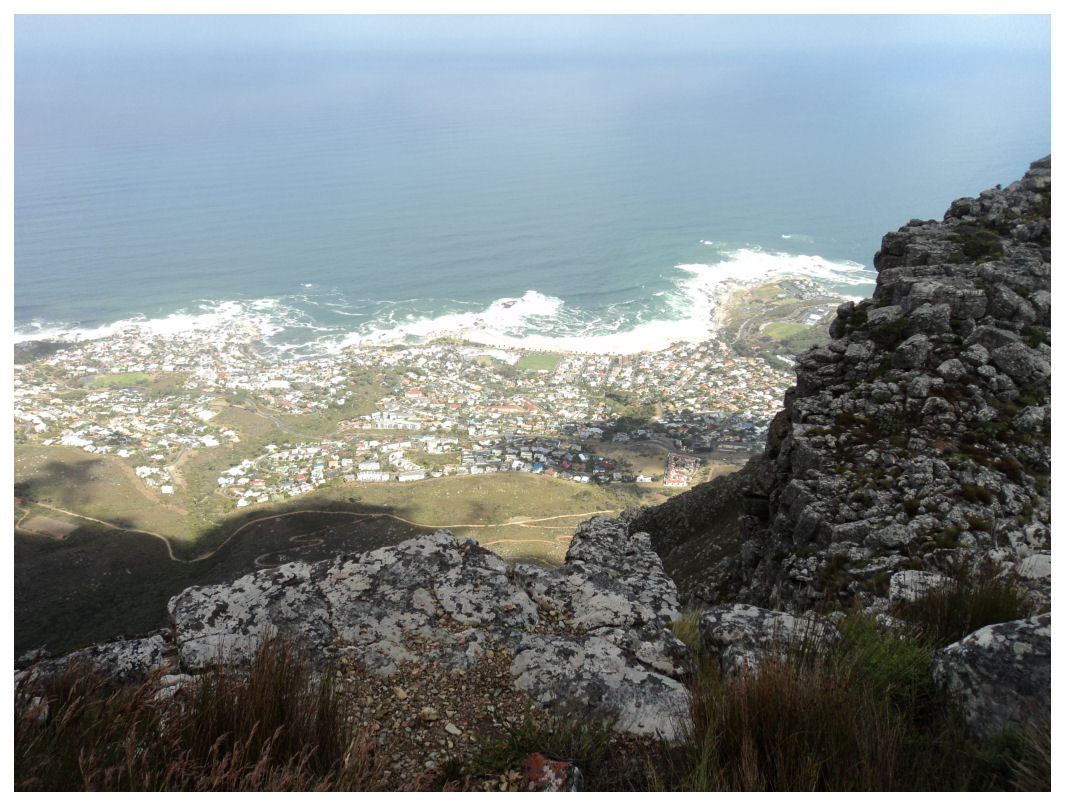
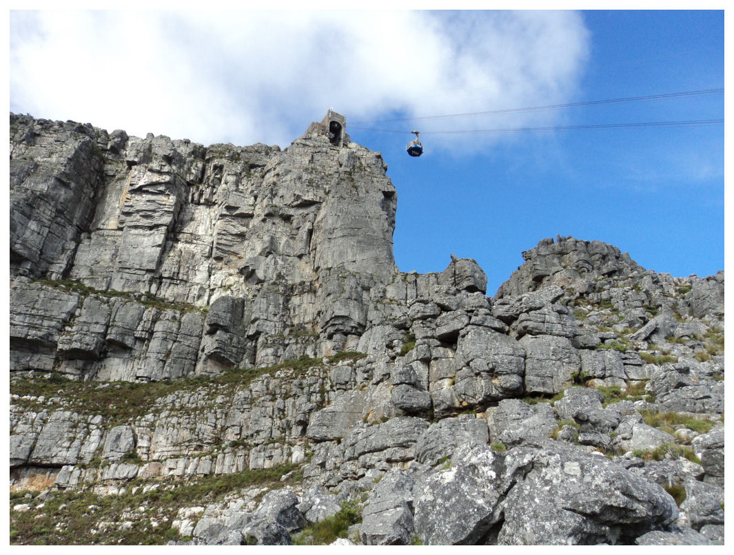
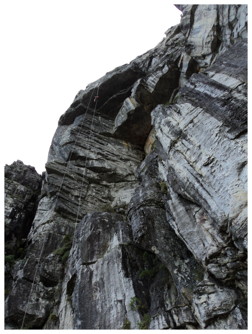 The route takes you straight up to the upper cable car station, but a 50 meter cliff prevents you from going further. From there you go to the back of Table Mountain where you are met by the spectacular view over Camps Bay. Here the path sometimes touches the cliff and it would be wise to keep to the left hand side of the path. Don't look down, a sudden wind can cause havoc and this unfortunately has happened before. When you get to the back side and you see ropes dangling from the top, then you know you are nearly there. This is where you can do abseiling from the top. We stood there and watched three girls from Germany sliding down the ropes. I remembered that my bucket list also had that entry somewhere at the top of the list. Still have to cross that out one day.
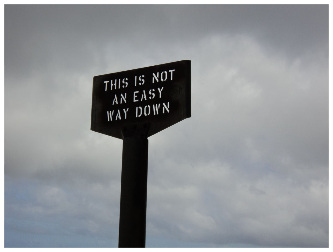 From the abseiling point it is easy walking to the the finish when you reach the sign saying that this is not an easy way down. Hell not. Coming up was hard enough. When you look up from here you can already see tourist hanging over the edges trying to get the best pictures. I have found though that when you get home and you look at the pictures, they are not nearly as awesome as being there. Anyway, being on Table Mountain is great. Walking up is even greater. Flying down on a paraglider will probably be the greatest.


