Monday, March 12, 2012

Gravel 101 - The re-exam

About six months ago I had a nasty fall with my bike on a gravel road in Namibia. What I didn't know then was that it was not only my bike that got written off, but also my confidence to ride gravel roads. I poured my heart out on the BMW forum and the response was so uplifting and inspiring that I decided to include a bit of gravel riding on a trip I had planned to Plettenberg Bay. 


My route from Cape Town took me straight to Mossel Bay where I had to "deviate to the scenic route" which would include the Montagu Pass as well as the Prince Alfreds Pass, both gravel roads. My other option was the easy N2 straight to Plettenberg Bay, but because of all the motivation and advice I received on the forum I decided to "go for gold".


I was a bit worried when I left Mossel Bay around 13:45 because rain was predicted for this area and I was already through two downpours heading towards Mossel Bay. The last thing I wanted was to slip and slide down Alfreds Pass. I was here to rewrite "Gravel 101 - Riding Gravel Roads" after I horribly failed the module which focusses on "Sand Riding Techniques". I was not prepared for "Gravel 201 - Riding Wet Slippery Roads" yet. I filled up in Blanco and was checking out the low lying clouds on the Outeniqua Mountains. I had no idea what it would look like closer to Knysna and Plett. I had no alternative other than crossing the mountain and hoping for the best once I got to Alfreds Pass which is over the Montagu Pass and via "Die Langkloof", 120 kilometres further down the road". No turning back then.

Montagu Pass

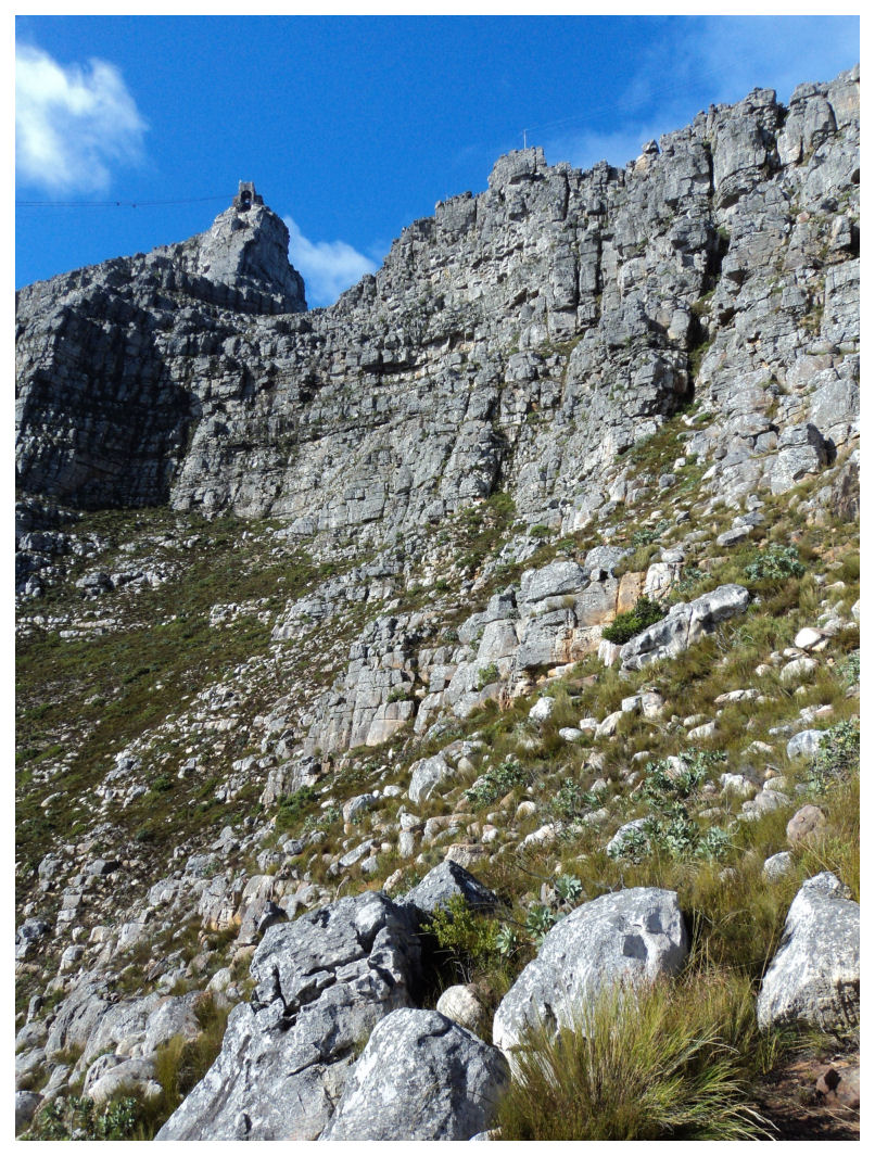
The Montagu Pass was as beautiful as ever. The first section of road into the valley was completely dry and when I left the tar behind I could already feel my whole body going into minor spasm attacks. After about a 100 meters I remembered the advice from the forum and slowed down considerably. "It was the sand that was a concern and not the hard gravel" I kept telling myself. Though I still had about a 2 hours ride ahead with rain looming in the distance I had to make sure that I kept a comfortable pace. After the bridge on the way up I realised like many times in the past that I feel much more comfortable going uphill compared to downhill. When I go down I have that fear of pulling the front brake and letting the front wheel slip out underneath me like I did many times as a kid on my bicycle. I have much more control over the speed as I go up and the chance of slipping on loose gravel is less. Fortunately for me, going up is basically all you do on the Montagu Pass if you approach it from the side I did. 


There were a few areas where the road was bad, especially where they made these little berms to stop the water from eroding the road. I managed that well and the only times I got a bit worried was when I crossed some loose pebbles which felt as I was riding on marbles. I was wondering if I shouldn't have deflated my tyres a bit, but earlier I consciously decided against that because of the long tar section through Langkloof. As I was getting closer to the top I was also getting closer to the clouds, but fortunately there was no rain, just mist. Once over the top there was still a 7km section to the R62. This section also had a bit of loose gravel but doing around 50km/h I had no problems keeping the bike under control.

Langkloof

The sun was shining brightly when I got my wheels back on tar. I looked at the mountain and all along the road I could see the clouds pouring over the back of the mountain. I knew what that meant, wet conditions on the other side. I wasn't going to let that deter me and decided to deal with the possibility of rain like my dad always says to me, "We'll cross the bridge when we get there". My ride over the Montagu Pass already inspired confidence and I was in good spirits.


My plan was to stay on tar until I got to Avontuur, but 50 kilometers down the R62 the lady with the sweet voice on my GPS suggested that I take a shortcut straight to De Vlugt. The nice lady didn't say anything about the road surface or conditions, but I guess the "Unpaved Road" clue on the GPS screen should've warned me that it was not going to be without mental and physical challenges. I stopped at the turn-off and thought that a short-cut might be a good idea to beat the rain to De Vlugt. I ventured out on my second gravel road with caution as this decision was rather unplanned. I didn't want to jinx my trip because of changed plans. As a good friend of mine always says, "You change your mind you lose your luck!"

Road To De Vlugt


Less than a 100 meters into unknown territory, I already started cursing myself for the weakness I have for sweet female voices. The road condition was not as good as the Montague Pass road, but with determination I decided to press on ahead. This was the part that tested the "Get back on the horse again if you still want to remain a cowboy"-theory. I wasn't about to let an ego thing make the decision for me. I decided to stick to the road regardless of untested theories. This time I was in it for the sake of "adventure". I have never been on this road before and didn't know what to expect, but with lots of patience and the occasional glimpse on my GPS screen I managed to negotiate all the tight turns by slowing down way in advance. The bit of advice from the forum that I really took to heart was the "take it slow" bit. Up until now I was fortunate not to have hit loose sand, but I am sure it would've been much easier to manage the sand travelling at 40 km/h rather than 80. 


The road meanders all along the Keurbooms River and has some very sharp bends with some sections that are very rocky.  I never exceeded 80km/h, most of the time sticking to 50 in order to enjoy the scenery as well. What a beautiful place it turned out to be. I had no idea when I was going to arrive at De Vlugt, but I got there much sooner than anticipated and was very much relieved that I survived another 25 kms of gravel road.


De Vlugt

I don't know what you would call De Vlugt, but it is beautiful little place nestled in the Outeniqua Mountains. On arrival I realised that I missed out on a beautiful section of Alfreds Pass, the part coming from Avontuur. It didn't bother me too much because I covered another gravel section which was also very nice to see and which gave me enough opportunities to build confidence. I stopped at the De Vlugt Tea Garden where I had a long conversation with the owner Annelize van Rooyen. She suggested I taste some of her homemade ginger beer and we talked about the pass and the amount of people passing her tea garden daily. When she mentioned that they were expecting rain I realised that I had completely forgotten about my concern for the rain. It was clear that rain is much needed in that part of the world, but I stood there thinking that I also wanted them to have rain, but "just not right now, please Lord". Annelize warned me that the road gets VERY slippery when wet and I started wondering if I can get the credit for Gravel 101 if I can pass Gravel 201 without pre-exam preparationsAfter finishing my ginger beer I decided to get on with my real challenge, Prince Alfreds Pass...hopefully in dry conditions. I had no idea what to expect on the other side of the mountain, but I still had this side to conquer first. I guess I was getting very close to that proverbial "bridge to cross" now.


The Prince Alfreds Pass


The road from De Vlugt immediately started out quite steep. The road condition was the same as on the road towards De Vlugt, but it was clear that it had more "unrepaired flood damage". I managed to get through some "dongas" but it was on this section when I once again had to admit  that my bike was physically too big for me. Around some of the tight corners the sand was eroded with only bumpy bed rock remaining. This means navigating around a corner while negotiating my way over open rock sections. Although I managed to stay on top I knew that if I had to put my foot down that I would not be able to keep my bike upright. This is what really concerns me about the size of my bike. I think doing cones would be a good exercise in acquiring the skills to balance the bike. On a slope however you only have the option (in my case) of one side where you can use your foot for support or the other side where you have less support than what Juju has in Orania. The other side would mean a definite topple over, or "omdonner" as I prefer to call it. Fortunately I am relatively OK with handling my bike around cones and passed these little challenges with flying colours. No harm though in acquiring more cone riding skills in future. 


I did the remainder of the steep section with ease, but it was while going through the Diepwalle Forest section that I had one of those "body spasm moments". The road, although well maintained, had loose gravel around some of the corners, and sometimes even on the straight sections. I was again doing between 50 and 80 km/h, but still taking it much slower than what I normally would've done in the past on a road with similar conditions. Then it happened...

You know that feeling you get when you hit a patch in the road and it feels as if your front wheel is doing its own thing and your back wheel doesn't know if it should follow or not? That feeling of riding on "slap pap" when all that stuff of "stand up, look up, open up" makes you wonder if it shouldn't be the other way around.... "Look down, slow down and stop your friggen bike!" My heart skipped a beat and my legs became like jelly. I was thinking what a bummer it would be if after all this gravel, I now lose it and put myself back in Namibia. I obviously have not conquered my fear, but I certainly have isolated it. It is that friggen wobbly that the bike does when I travel over loose gravel, THAT is the fear which resulted from my accident in "Nam". A similar feeling I got the first time I jumped out of an aeroplane and I couldn't find something solid to stand on before my chute deployed properly. That (un)familiar feeling of not being in control of the situation. 


I went through the loose gravel unscathed only the by the grace of God and had to stop to catch my breath. I was a bit disappointed to know that the fear has not subsided after the morning's gravel exposure, but on the other hand I now knew exactly WHAT the fear was. It's not gravel roads per se, it is the inability to control my bike in these conditionsI could still enjoy the undiscovered roads, as long as I do it at a comfortable pace and never encounter loose soil. The gravel road, the bends, the loose rocks, are all manageable. It is the fear of hitting that loose patch and losing control that freaks me out. 

The ride was wonderful, it never rained and I arrived safely in Plettenberg Bay about 3 hours after my departure from Mossel Bay. I feel much better today than I did three weeks ago when I wrote that heart-rendering post on the forum. My bike is actually dirty today and I am very proud of it. I will work on that loose floating feeling and how to counter-act when it happens. In the meantime I will continue to enjoy my bike and make good use of it on tar as well as on gravel. I am not there yet, but this ride was a huge confidence booster and put me back in the saddle again. I guess it is all about staying within your skill level and taking your time. It IS about the journey and not the destination. And eventually it IS about staying alive to tell the story. By riding slow you can even have some pictures to show...... 

Monday, March 5, 2012

Bucket List Climb - Table Mountain

It's that time of the year where the cold fronts start making their way closer to the African continent. To me that just means one thing....depression. This weekend a second weak cold front aimed at the Cape, but fortunately didn't spoil the weekend too much. Last week I was a bit depressed because my weekend didn't result in much and I was fearing that I might have a second one in a row. Fortunately a friend of mine called unexpectedly to ask me if I wanted to go paragliding at Porterville. She recently had a very unfortunate accident on Lion's Head and broke  her back. She explained to me what was crushed in her back and everything but I was just relieved that she could still walk. She is on the road of recovery and obviously determined to get her life back on the road...and her paraglider in the air. After weighing up our options and talking about bucket lists and things you have to do before you die, we eventually dropped the paragliding idea and decided to walk up Table Mountain instead. Porterville was too far to drive and Lion's head was going to blow out, and seeing that walking up Table Mountain was still on her bucket list, we decided to do just that.

I have walked up Table Mountain a few times, but I cannot exactly remember how many times. There are many routes that one can take, so you can basically start on any side of Table Mountain and reach the top in one way or the other. I would say the most boring way up is Platteklip Gorge with steps taking you into the gorge and spoiling the view and excitement completely. Perfect place to take your family for a walk. I did another route some time ago called the India Venster ("Window"), but I remember getting lost at a point and wasting about 45 minutes trying to get back to the route. The name India Venter apparently comes from a hole in the rocks that when viewed from a certain point resembles the map of India. If you look through it you see spectacular views on the other side. I still have to find it. We once did a walk over Devil's Peak all the way to the top, and got slightly lost as well but managed to find our way again. Anyway, with a slightly damaged paragliding patient I didn't want to take on a hectic route, but Platteklip Gorge was just too easy. We made the decision that we will walk up halfway and where the road splits, we will make a call depending on her back. 


We left from just underneath the Cable Car station at the bottom and headed up on a relatively easy path to the Main Contour Path. There we would make the decision to walk along the contour path to Platteklip Gorge, or to head into the direction of India Venster. Starting time was 8:15 and the pace was not too fast. We were followed by two lady tourist who managed the footpath well with their fancy shoes and tank tops. They eventually turned away to Platteklip Gorg, which is a good idea if you are not protected against the sun. We decided that we are going to try India Venster, despite the warnings that it is not for inexperienced climbers and that navigation is difficult. No Shit Sherlock, that is why I got lost the last time. 

The climb was getting steeper, so we made frequent stops to appreciate the view and to sometimes wave at the passengers in the cable cars. When you look in front of you and at the top cable car station you wonder if you will ever get up there. I was a bit worried about my hiking partner, but she was really doing well and constantly had to re-assure me that her back was fine. As we were walking up we noticed some paragliders taking off from Lion's Head and we had to convince ourselves that the site will be blown out quickly and that they would all have to land soon. We were there to cross out an item from a bucket list and we were going to complete it, come hell or high water.

Navigating India Venster is indeed a bit troublesome. You move away from a clear footpath and eventually end up climbing rocks. It is not too difficult to climb, the rocks all seems to have natural handles where you can grab onto, but if you did not do the jungle gym thing when you were a kid you might struggle to get up. To solve the navigation issue some yellow footprints were painted on some of the rocks, and sometimes you are really please to see one in  the distance. There are times when you look up and think to yourself that you might be stuck, but somehow you find your way again and you move on. I was a bit disappointed when I reached a difficult climbing spot where they actually put up some stainless steels climbing footsteps and chains. Although this obviously helps a lot, I think they have dropped the difficulty rating by a few bars. My only issue getting up there was my walking stick that was always in the way, but we both did the climbing with ease. Every now and then we would throw our eyes into the direction of Lion's Head to see if the paragliders were gone, but somehow they managed to keep flying.

The route takes you straight up to the upper cable car station, but a 50 meter cliff prevents you from going further. From there you go to the back of Table Mountain where you are met by the spectacular view over Camps Bay. Here the path sometimes touches the cliff and it would be wise to keep to the left hand side of the path. Don't look down, a sudden wind can cause havoc and this unfortunately has happened before. When you get to the back side and you see ropes dangling from the top, then you know you are nearly there. This is where you can do abseiling from the top. We stood there and watched three girls from Germany sliding down the ropes. I remembered that my bucket list also had that entry somewhere at the top of the list. Still have to cross that out one day.

From the abseiling point it is easy walking to the the finish when you reach the sign saying that this is not an easy way down. Hell not. Coming up was hard enough. When you look up from here you can already see tourist hanging over the edges trying to get the best pictures. I have found though that when you get home and you look at the pictures, they are not nearly as awesome as being there. Anyway, being on Table Mountain is great. Walking up is even greater. Flying down on a paraglider will probably be the greatest.

We reached the cable car station at around 11 am. Taking into account the many stops we had, it probably could've taken us only two hours to get to the top. Table Mountain is a 1000 meters high, but you do only start climbing half-way up. Platteklip Gorge is the easy way up, India venster the slightly more interesting and daring way to go. All in all we enjoyed it and managed to shorten her bucket list. My list? Yeah, I still have a few things to do....Oh, and as we were going down with the cable car we saw that the paragliders were still flying. Next time....

Breakfast Review - "Die Volksmond"

If you have read some of my other posts, you might've picked up that English is not my first language. I have a friend that likes to point out my grammar mistakes in my posts, but I try. I am actually Afrikaans speaking, which in the current South Africa is not really that great to be. The ruling party always associate Afrikaans with the apartheid era and try their best to kill the language. Just last week they proclaimed that three official languages used in state departments have to at least contain two African languages. That means that English, which is understood by most South Africans will be used, along with two other African languages. Where does that leave Afrikaans? Well, the ANC hopes it will disappear like they want the whites to disappear. But my blog is not on politics and the last thing I want to have is a debate on language issues. The reason however why I mentioned this language issue is because of my breakfast which I had at the Afrikaans Language Monument situated on the Paarl Mountain. 

We were on our way from Bain's Kloof back to Cape Town when I remembered that I previously stopped at this restaurant close to those huge "stalagmites" which obviously  represents something of the Afrikaans language. You have to enter the gate to the monument if you want to get to the Volksmond Restaurant where we were planning on doing a quick meal, but it is not free. Some way we have to finance our own language I guess. The entrance fee is R15 per person, but if you only want to go to the restaurant, you have to pay R5. The reason for this is that people say they are going to the restaurant and then walk up to the monument. Although I feel very tempted to say that even Afrikaans people seems to take liberties in this country, I have to admit that every time I've been there I have actually heard more foreign languages than Afrikaans. I guess we all take liberties then. But because of that everyone has to pay to go to the restaurant, which for me is not really fair if you want to support the restaurant. At least I knew the money was going for a "good cause".

But if paying was OK because of the "good cause", then I cannot really complain at the prices of the meals either. The menu is rather limited, but nothing less than what you would find at any average coffee shop. It was also nice to see that the menu was in Afrikaans as well as English, but I guess that you would also find at any average coffee shop in South Africa. I went for the "Afrikaans Breakfast" at R42. Not very different than what you would find on other menus under the title "English Breakfast". I wondered why they would call it an Afrikaans breakfast, because what do Afrikaners really eat for breakfast? Mieliepap? I think more Africans eat mieliepap than Afrikaners to be honest. Anyway, the food tasted good and even though R42 was a bit steep for that breakfast I told myself it was for a good cause. 

One thing that I can say about the place was that the view over the Franschkoek valley is spectacular. After the noise at Tweede Tol I really appreciated the tranquillity up on the hill.  If you ever want to go up there, do it for the view at least. The food is not bad either, just in my opinion a bit expensive. But like I said...it's for a good cause.

Too much toll to pay at Tweede Tol

I few weeks ago on my way to Tweede Tol ("Second Toll"), a picnic site at the start of the Bain's Kloof Pass on the Ceres side, I was turned around by traffic police due to veld fires in the Limietberg Mountains. My son was clearly upset because he wanted to catch fish in the Witte River that flows past the camping and picnic site.   Tweede Tol is situated inside the Limietberg Nature Reserve, so taking fish would not have been allowed by a dad that really believes in nature conservation, but as long as he was under the impression that we were going to catch huge fish and take it home to eat, I wasn't going to kill his spirit. So we made a second attempt this weekend.


We arrived at the gate at around 9 am but was quite disappointed to see that we were not early enough. All the picnic spots were almost taken and we ended up sitting at a table smack bang in the middle of the sun with no trees in close proximity. This was way too far from the river, so we drank coffee and put everything back in the car to head down to the river. I could see that the people that have already made them comfortable at the picnic site was NOT there to enjoy the tranquillity of the river, but rather to have a good time. You could also see that this is a regular spot for them to spend their weekends as they were clearly geared up for the event. 


Apart from the fact that we couldn't find fish, the river didn't disappoint. The water is crystal clear and was rather warm for streams coming from the mountains. I ventured a bit further up the river to search for fish, but the noise from the camping site seemed to follow me. When I returned to where my family was sitting, I realised that the crowds have moved down from the picnic site to the riverside and decided there and then that it was time to leave. What an awesome place spoiled by inconsiderate people. We packed up and left the empty Klipdrift bottles behind knowing that peace and quiet is not what you will find if you decide to visit Tweede Tol. Another beautiful site polluted by human beings.

Wednesday, February 29, 2012

Did you say "Chips", Dad?

I was having potato chips at the beach, something we hardly ever eat because my wife believes it is "bad food". As usual the seagulls were flocking around me looking for some leftovers. I never feed them because I believe they should be looking after their own diet and not be eating the "bad food" us humans eat. I was wondering if they would actually take something from my hand and armed with my iPhone I was hoping of capturing it. I must say I was quite impressed when I got this picture from my first attempt. 

I went home and later the evening showed my 5-year old son the picture thinking that he might appreciate the fact that the seagull came so close to his dad. His first question was..."When did you have chips, Dad?"

Thursday, February 23, 2012

Peer Pressure

South African Bowlers


Sunday, February 19, 2012

Snorkeling at Pemba

It's been a while now that I have written anything on my blog. It is not that I have been busy or that nothing is happening in my life, it is just that I somehow don't want to spend time in front of a laptop if I can be outside. Each time I want to come sit down and write something, I find something better to do...usually outdoors as the summer we've had this year is just brilliant. The summer has been quite hot and the wind has also been good for kitesurfing. I've posted some pics of my recent trip to Pemba on facebook, but not all the people that read my blog is on facebook and they have asked me to put the pictures on my blog.

If you ever are fortunate enough to travel to Pemba, a small town in the northern province of Mozambique called Pabo Delgado, you will find that there are quite a few things you can do. There are also coral reefs (Quirimbas Archipelago), so scuba diving and snorkeling is quite popular. For more information on Pemba just Google it and you will see how beautiful this part of Mozambique is. I am not going to re-write what's written on the Internet, I just want to show the pictures of my snorkeling trip I had.

On my last trip to Mozambique I had the opportunity to take a boat and go snorkeling on one of the many coral reefs not far from Pemba. We left from a place called the Bush Camp on a wooden dhow boat called Eve. I was glad that we took that one, because when we arrived it was laying next to another fancy deep she fishing boat which looked like it was for wealthy foreigners and I was not in the mood for looking rich. Eve belongs to a South African who has been taking people for diving cruises in Mozambique for some time now.


Wednesday, January 25, 2012

Wind"GURU"...?

I make a lot of use of the website called "Windguru" to plan my kiting. Although I have a lot of respect for this website, I have to admit that sometimes what they have predicted and what is experienced is not always the same....

Wind predicted for today on Windguru.....12- 17 knots


 Wind reading on the local anemometer....0-3 knots


Proof that there is not a breeze at all from the local webcam....


I guess I had my hopes up for nothing. No kiting for me today....

Monday, January 16, 2012

Expensive Advertising Space


I am sure it costs Turkist Airlines a pretty penny to advertize here....

Why would I want to blog...?

A friend of mine recently asked me why is it that I blog more when I am working and when I am on vacation I hardly ever do any posts. Well, look at this and ask yourself where you would rather be during your vacation, on the beach or behind your laptop???